Bridge Completion at Stub Stewart State Park

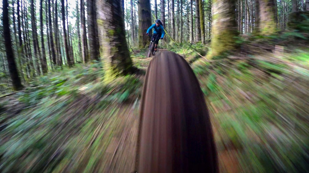
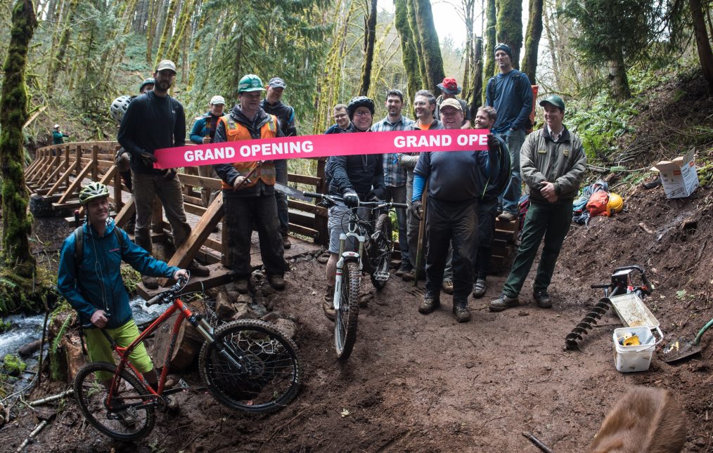
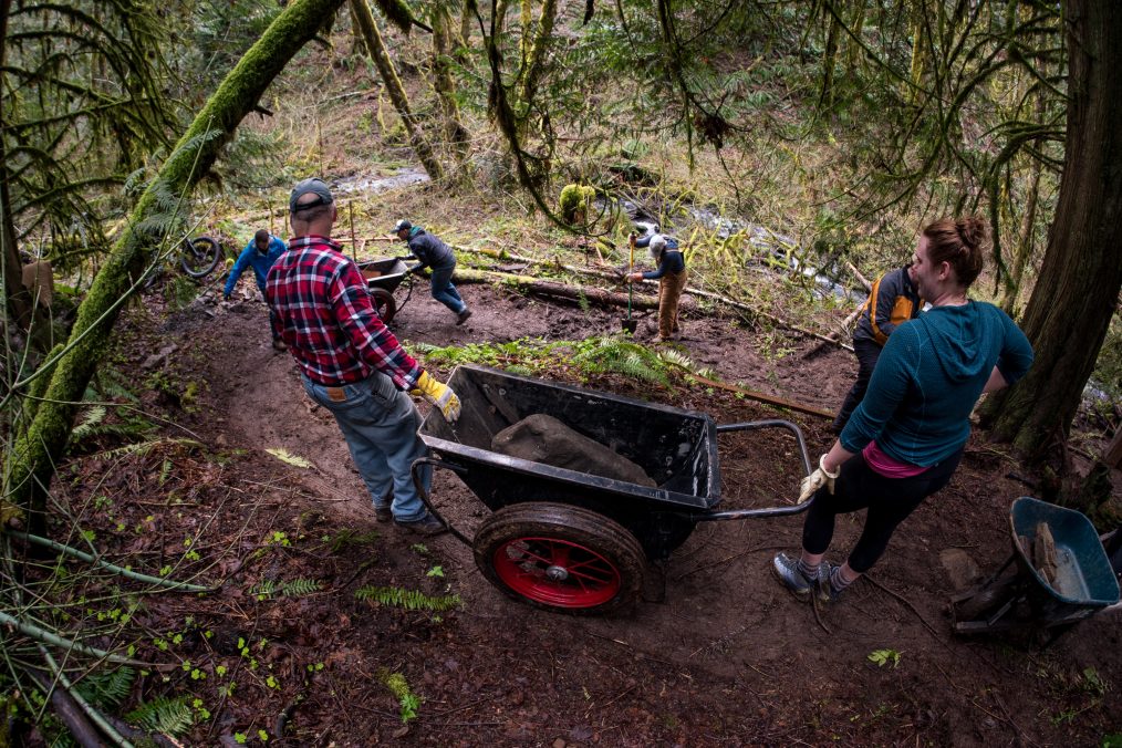
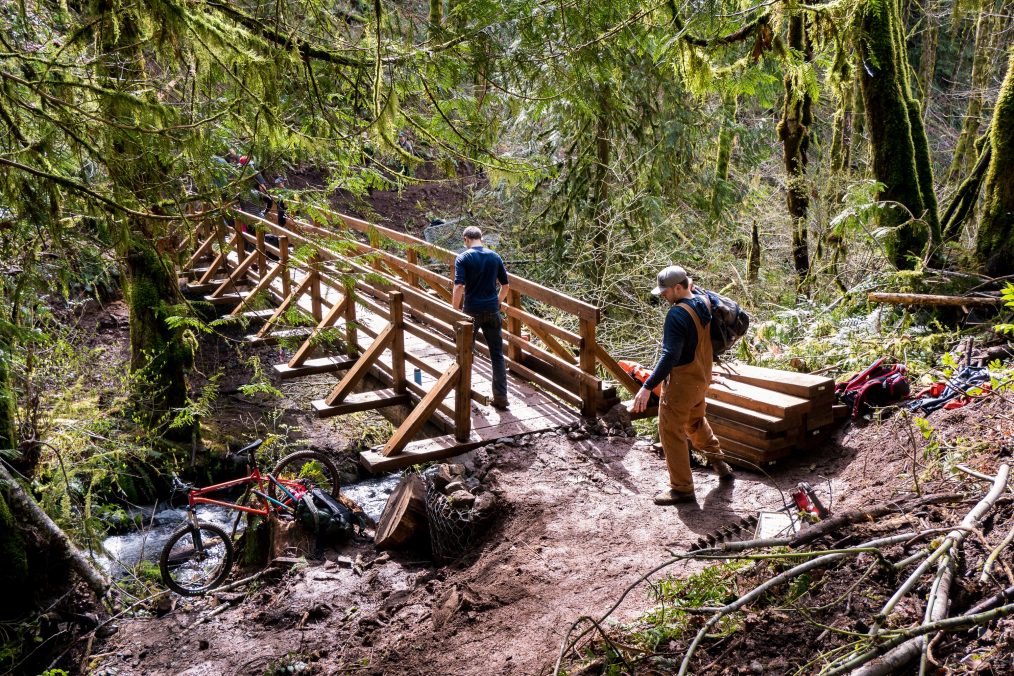
Congrats to everyone! The two year project to build three bridges in the mountain bike and mixed use trail area of Stub Stewart State Park, OR came to an end this weekend with the completion of the last bridge. This work was no easy feat and took 100’s of volunteers to help move 20+ tons of rock and materials into the remote areas where the bridges were built.

These 100’s of volunteers put in 1,500-2000 worth of combined hours and spanned many groups including NWTA, Oregon State Parks, Oregon Equestrian Trails, Westside Trail Federation, and the Northwest Youth Corps. 

Thanks to Oregon State Parks for making this all possible, including finding grants for Northwest Youth Corps to build the bridges. This gave 19-24 year old America Corp volunteers an opportunity to learn two weeks of carpentry skills. 

Inter Glacier, Mt. Rainier

Just got back from the Inter Glacier on Mt. Rainier. We opted to head to Rainier to escape Oregon’s rising freeze levels and to avoid the crowds at Paradise Glacier. After a dry approach for a few hours we finally hit the Glacier Basin and got our first glimpses of the Inter Glacier. The terrain was a little thinner than Corey, Kristian and I hoped for but still enough dust on crust to get some good turns in. This is definitely some of the best snow we’ve all ridden in years for October and I can tell the stoke level is growing as each storm rolls in.

FIRST TURNS OF THE SEASON, MT. HOOD

It’s time!!! After the storm that hit the PNW last week, it left Mt. Hood with fresh powder mid-week and corn by the weekend.  So Cory BetzelKristian Gamiao and I headed up to get our first fresh turns of the season. After dry approaching up to Silcox Hut it was a relief to find 6″ of soft snow on the skin up thru the canyons that lead to Palmer Glacier. By the time we hit the top of Palmer at 10am, the fresh snow turned into perfect corn and rode perfectly for about 1,500 feet.

I hope this is a foreshadow of what the rest of the season holds….

When it rains… hit the river trails.


So far this season, it seems as if the weather is perfect during the week and raining on the weekend. Luckily a lot of the lower elevations are clear of snow already, so when you can’t harvest spring then you might as well ride some single track. I had a great time taking two friends out for their first mountain bike experience. Happy they returned safe and are stoked to ride again!

Weather Forecasting: What I’ve learned so far…

I’ll be the first to admit it, I’m no weatherman and I personally feel like it’s one of the hardest things to predict when it comes to snowboard mountaineering. I often get asked tho, where do you look for weather, when do you start looking and what are some good tools. It’s simple when the weather calls for a blue bird day, but what if it says partly cloudy, a chance of snow, etc. How do you really know when you’re weather pocket is going to be, what elevations will the mountain be socked in and so forth? Well… I’m still learning that too but here is what I’ve learned so far for figuring out weather in the PNW!


When do you start looking at the weather and what is my process?


Ten days out from an objective is generally when I start looking at the weather. Since I’m a weekend warrior, I can’t always just head out when the weather is perfect. So a lot of the time I have to make a decision if the weather is “good enough” for a trip up a mountain. I find that weather 10 days out is still a long shot and if it looks like a storm front is starting or leaving around that date, then it could happen a day before or after too.

I usually hop on OpenSnow and check out the resorts in that area for their 6-10 day forecast. I’ve created a dashboard on OpenSnow to see all of the resorts in the PNW region and this gives me a better idea of where the storm is coming in the heaviest and where the freeze levels are.

Screen Shot 2016-04-02 at 9.16.24 PM

OpenSnow.com

Five days out is when I really start paying attention. Since I’m signed up for Open Snow, their daily forecasts really give me a good 5 day outlook for the resorts, but what if I’m not touring near a resort? This is when I turn to Mountain-Forecast and NOAA. I find that Mountain-Forecasts forecasts are little too optimistic for good weather, but their wind speeds and freeze levels are reliable. I find that NOAA is often too optimistic when it comes to snow amounts but offers a lot of amazing tools. So I kind of aim in-between of what both are saying.
Screen Shot 2016-04-02 at 10.57.02 PM

Mountain-Forecast.com

For NOAA, I use it in three ways. One is to look at the broad PNW weather. The second is to use their pinpoint forecasting by searching for something like “Mt. St. Helens noaa” and then clicking on the map to get the elevation and aspect I want. From there, you can get a 7 day forecast but it’s really general. To really dive into the weather, you need to go to the menu in the bottom and use the “Hourly Weather Forecast” and the “Forecast Discussion” and I’ll discuss those below. The third way I use NOAA is their cloud level predictions. This is really useful for trying to figure out if the mountain will be socked in or not. Notice that the forecasts are in UTC time, so you’ll need to translate them into your region.

Screen Shot 2016-04-02 at 9.32.15 PM

NOAA Pinpoint Forecasting


Screen Shot 2016-04-02 at 9.46.11 PM

MET MOS Ceiling Height

One to three days out is when I really start to use the “Hourly Weather Forecast” and the “Forecast Discussion” from NOAA.  Using the “Hourly Weather Forecast”, let’s you pull up a graph with a handful of very useful weather forecasts like wind, temps, precipitation potential, sky cover, etc. I find that these will continue to update and narrow down up until the night before. So it’s highly useful in figuring out good weather pockets. Remember when using this tool, it’s only for the elevation you picked when using the pinpoint map, so you can pick another zone if you’d like to check another elevation.

One thing I learned last year while flying in a Cessna is that pilots are often looking at the weather the same way that mountaineers do. Single prop and smaller planes are usually flying around the same elevation that mountaineers are climbing at. So I find that you can get some useful information from the “Forecast Discussion” section of NOAA and reading the aviation forecast. It’s a little hard to decipher sometimes, but do some googling and you’ll easily figure it out and understand what they are talking about with cloud types and visibility. I find that looking up the weather to the closest area to where you’re climbing on Wunderground works too. You’ll see on the right side of the forecast will have some aviation codes and will provide you cloud levels and what elevations they are at. This information, combined with the cloud level predictions should give you a better idea of if the mountain is going to be socked in during your climb and what time.

I keep checking these forecasts until I’m leaving the door. Just remember tho, weather on a mountain can change at any time, so always be prepared.

Screen Shot 2016-04-02 at 10.08.34 PM

NOAA Hourly Weather Forecast

Screen Shot 2016-04-02 at 9.58.50 PM

NOAA Forecast Discussion


Screen Shot 2016-04-02 at 9.58.28 PM

Wunderground.com


What tools or apps do you use?


As mentioned above, I often use these tools for checking the weather forecasts:

I hope you find this information useful and I plan to keep writing more posts as I discover new tools to help me with weather forecasting.

Dry Trails at Stub Stewart

With my camera in the shop and inconsistent cloud levels forecasted for Mt. St. Helens, we bailed on our climb and headed out to Stub Stewart this weekend for some dry trails. Come check out this great trail network that’s within 40 minutes of the Portland Metro area! You’ll find everything from a freeride park down to beginner XC trails here. But snag a trail map before you go here, MTB project and Trailforks didn’t have 90% of the trails that exist there.

Finding Dry Land in the Midst of Winter – Alsea Falls, OR

With the high freeze levels leaving most of the PNW foothills drenched in rain this past weekend, a few of us headed south to ride on two wheels. Arriving at Alsea Falls Trail Network in Oregon, we found exactly what we were hoping for, dry clay!

Since we arrived without knowing a work party was going on in the upper trails, we talked to Mike, the founder of the trails, and he gave us the run down of what was prime to hit and encouraged us to spend the day riding since it was our first time there. Spending most of our time on Springboard, a long and fast flow styled trail, we setup a few quick shots on some of the berms and rollers and took in the beautiful green and red contrast. After having our fill of 3 laps, we packed up and headed back north… into the rain.

Two Attempts, No Summit on Mt. St. Helens

Compared to last years horrible snow season and dry approaches for 3 hours up to 6k feet, Mt. St. Helens feels like an entirely new mountain this year. On our first attempt this season, we climbed in beautiful blue bird conditions, except for some nasty 45-60mph winds. After reaching about 6k feet and watching the gullies cross load, we played it safe and rode some stable powder down.

With clear skies in the forecast again, Erin and I headed out for an overnight mission on Mt. St. Helens about a month later. Rising to a clear beautiful morning, we were met with a complete wall of white over 6k feet. After looking at the updated weather forecast and finding out the clouds were not going to retract, we decided to play it safe and enjoy a 3k foot run down in perfect powder.